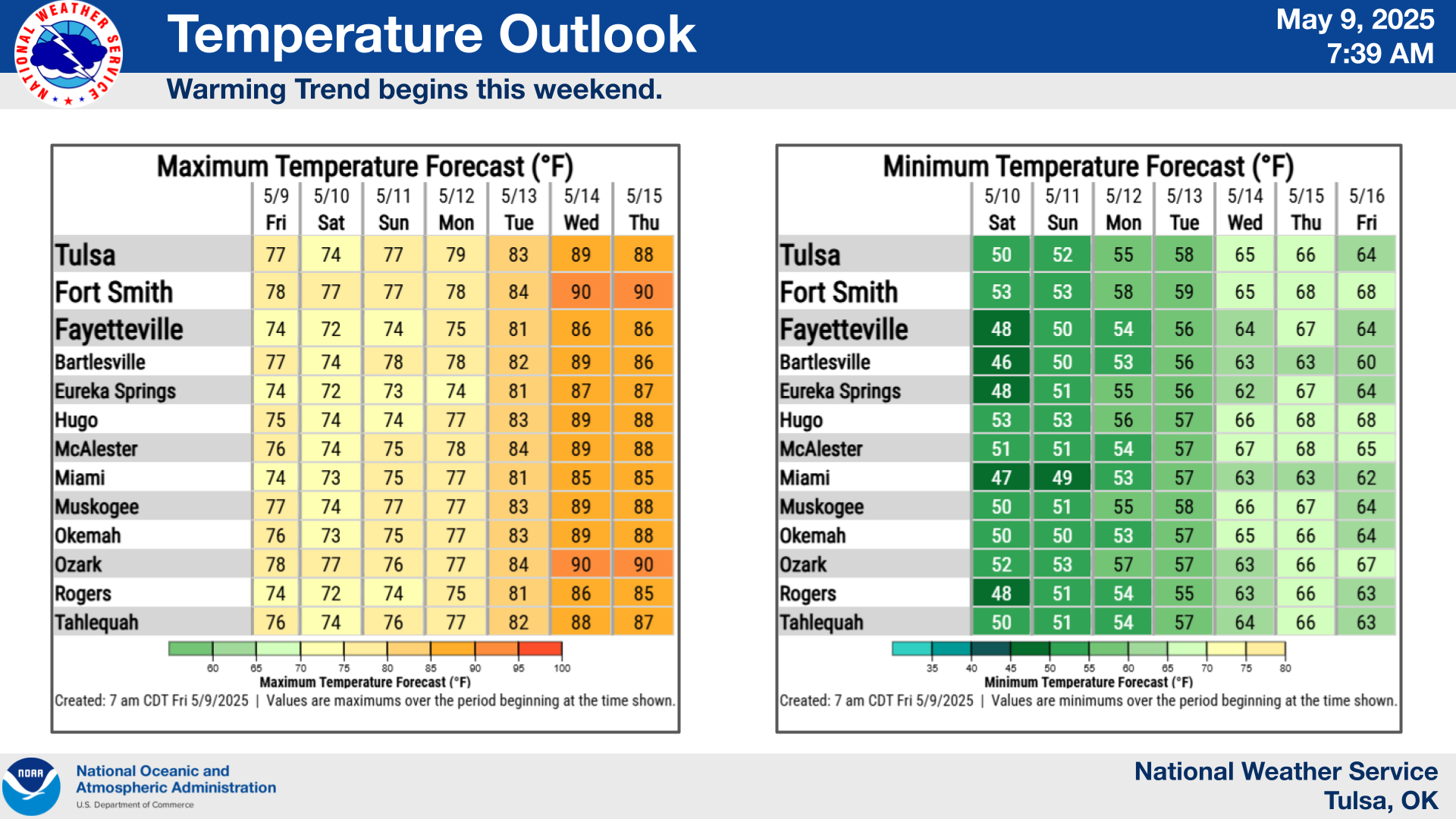
National Weather Service Tulsa heat graphic for western Arkansas and eastern Oklahoma, updated Saturday morning.
Hey Fort Smith — the heat situation got worse since this morning's update.
The National Weather Service in Tulsa has upgraded part of the Arkansas River Valley to an Extreme Heat Warning, with heat-index values expected to reach as high as 110° to 112°F Saturday afternoon.
The warning includes north and central Sebastian County and southern Crawford County and remains in effect until 7 p.m. Saturday.
And this isn't a one-afternoon thing.
Another Extreme Heat Warning is already scheduled from noon until 7 p.m. Sunday for the hardest-hit portion of the Arkansas River Valley.
That is a meaningful change from the Heat Advisory that was in place when we posted our earlier weekend weather update.
A Heat Advisory is still active for surrounding portions of western Arkansas, including northern Crawford County, where heat-index readings may still reach roughly 109°F.
But the Fort Smith-area warning zone has now crossed into the National Weather Service's higher alert category.
An Extreme Heat Warning is used when dangerously hot conditions are occurring or expected and the threat of heat-related illness becomes significantly greater.
In plain English: this isn't really the afternoon to prove how tough you are.
Around mid-afternoon Saturday, Fort Smith was already sitting around 103°F, and the temperature is expected to top out around 104°F.
Sunday could be even hotter, with temperatures around 107°F possible before the humidity is even factored into the heat index.
That's how we get into the 110° to 112° territory the National Weather Service is warning about.
If you're working construction, mowing, unloading trucks, working around parking lots, moving furniture, playing sports or doing anything else physical outside, these are conditions where heat exhaustion can turn into heat stroke fast.
And pavement makes it worse.
Parking lots, concrete sidewalks, roofs and other hard surfaces soak up heat all afternoon and throw it right back at anybody working around them.
That's especially relevant around convenience stores, restaurants, construction sites, outdoor events and anywhere employees are bouncing between air conditioning and brutally hot pavement.
The National Weather Service is telling people to drink plenty of fluids, spend time in air conditioning, stay out of prolonged direct sun and check on relatives and neighbors who may be more vulnerable.
If you have employees or family members working outside, give them actual cooling breaks.
Standing beside the building for two minutes isn't much of a break when the heat index is pushing 112.
Get into shade or AC, cool down and drink water before going back out.
And absolutely don't leave children or pets inside a parked vehicle.
Vehicle interiors can become deadly in minutes during this kind of heat.
There's also another Fort Smith issue overlapping with the warning.
City water customers south of Zero Street are still under mandatory Phase II water-conservation measures through Sunday night.
Those restrictions were put in place after a damaged 24-inch water main caused a major water loss and left reservoirs serving south Fort Smith needing time to recover.
So we're dealing with a pretty lousy combination.
The hotter it gets, the more water everybody naturally wants to use.
At the same time, Fort Smith needs unnecessary water use to stay down while reservoir levels recover.
The priority is pretty simple.
Drink the water you need.
Stay cool.
Keep people and pets safe.
The lawn can look ugly for a few days.
The truck can stay dirty.
Sunday isn't offering much relief either.
The National Weather Service says another hot and humid afternoon will bring another round of extreme heat to the lower Arkansas River Valley, again with heat-index values potentially reaching 112°F.
There are still small chances of showers or thunderstorms around the region, but forecasters say any rainfall isn't expected to be enough to reverse the ongoing drought trend.
The prolonged hot and dry pattern has already been worsening drought conditions across western Arkansas and eastern Oklahoma.
And this doesn't appear to disappear after Labor Day weekend.
NWS Tulsa says heat stress will likely continue affecting daytime outdoor activities into next week.
So if you've got outdoor jobs or projects that can be moved earlier in the morning, that's the smarter window.
Same thing with yard work.
If it can wait until later in the evening, let it wait.
And if you know somebody elderly, somebody living alone or somebody whose air conditioner has been struggling during this heat streak, give them a call.
That takes about thirty seconds and could actually matter.
Community takeaway: The Saturday Heat Advisory has been upgraded to an Extreme Heat Warning for north and central Sebastian County and southern Crawford County. Heat-index values may reach 110° to 112°F before the warning expires at 7 p.m. Another Extreme Heat Warning is scheduled from noon to 7 p.m. Sunday. Surrounding areas remain under a Heat Advisory. Avoid unnecessary strenuous activity during the afternoon, take real cooling breaks, stay hydrated and check on people who may not have reliable air conditioning.
Fort Smith Community Hub
Keeping our community connected, one story at a time.
📍 Fort Smith, Arkansas · 479 · iam479.com.
Sources: National Weather Service Tulsa — current River Valley heat warnings and forecast · National Weather Service — current watches, warnings and advisories


Comments
Post a Comment